

PROJECT Cemetery Locations - Using Google Earth with the 50K Cemeteries
50k Cemeteries (Unindexed Cemeteries)
Once Google Earth is installed and the data for the unrecorded cemeteries applied, the following become relevant:
- What does the map show
- Cemetery Names
- The pop-up window
|
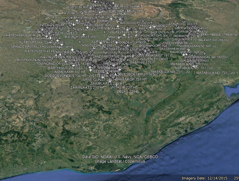
1. What does the map show?
Google Earth Map opens with a high-level view of Southern Africa showing all the cemetery locations with a “+” icon. The standard features of Google Earth can be used to zoom in or out, rotate the image, or fly to various Placemarks or coordinates. Places of interest shown in the default Google Earth maps also assist with navigation. |
 |
|
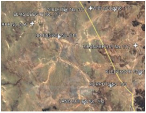
2. Cemetery names When loaded into Google Earth, the new image shows some 13 000 previously unknown cemetery locations. By zooming in on the general area of interest, the icons separate and the cemetery or farm name pops up next to the Cemetery mark (“+”). |
 |
|
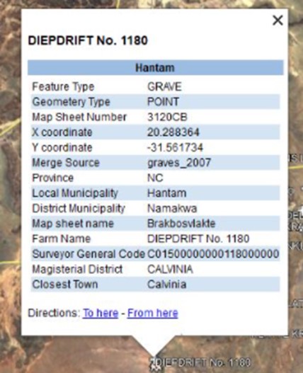
3. The pop-up window
Clicking on the position “+” loads a pop-up window with pertinent information, including:
|
 |